وبلاگ تخصصی مهندسین مرتع و آبخیزداری
Powerd by: Parsiblog ® team.
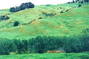
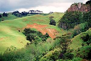
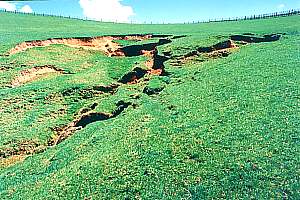
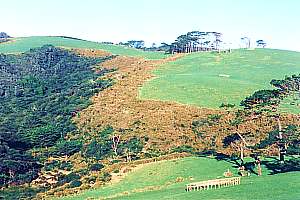
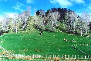
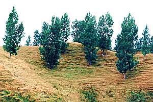
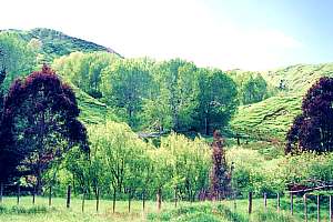
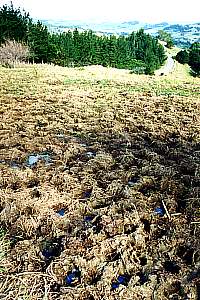
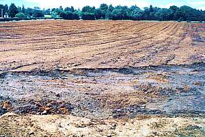
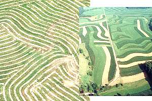
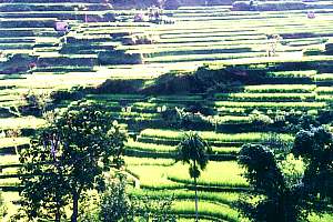
عکس انواع فرسایش(چهارشنبه 85 اسفند 9 ساعت 4:28 عصر )
» مجتبی رجب پور و رضا نوروزی
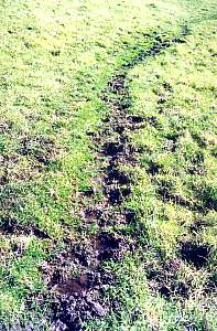
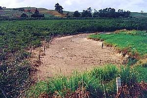
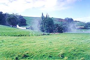
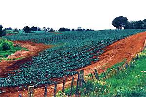
»» نظرات دیگران ( نظر)
موقعیت کویر لوت(چهارشنبه 85 اسفند 9 ساعت 3:54 عصر )
» مجتبی رجب پور و رضا نوروزی


»» نظرات دیگران ( نظر)
دستاوردها و تجربیات ایران در مهار بیابان زایی (برگردان انگلیسی-1(یکشنبه 85 اسفند 6 ساعت 3:16 عصر )
» مجتبی رجب پور و رضا نوروزی»» نظرات دیگران ( نظر)
فشرده ای از آنچه که گذشت به زبان انگلیسی:(یکشنبه 85 اسفند 6 ساعت 3:16 عصر )
» مجتبی رجب پور و رضا نوروزی»» نظرات دیگران ( نظر)
دستاوردها و تجربیات ایران در مهار بیابان زایی (برگردان انگلیسی-(یکشنبه 85 اسفند 6 ساعت 3:13 عصر )
» مجتبی رجب پور و رضا نوروزی»» نظرات دیگران ( نظر)
روز جهانی بیابان زدایی(یکشنبه 85 اسفند 6 ساعت 2:55 عصر )
» مجتبی رجب پور و رضا نوروزی
»» نظرات دیگران ( نظر)
یند چوبی(پنج شنبه 85 اسفند 3 ساعت 3:55 عصر )
» مجتبی رجب پور و رضا نوروزی

»» نظرات دیگران ( نظر)
بند سنگی(پنج شنبه 85 اسفند 3 ساعت 3:53 عصر )
» مجتبی رجب پور و رضا نوروزی


»» نظرات دیگران ( نظر)
بند چپری(پنج شنبه 85 اسفند 3 ساعت 3:50 عصر )
» مجتبی رجب پور و رضا نوروزی


»» نظرات دیگران ( نظر)
Installing and Using Check Dams ( سدهای کنترلی )(پنج شنبه 85 اسفند 3 ساعت 3:43 عصر )
» مجتبی رجب پور و رضا نوروزی


»» نظرات دیگران ( نظر)
لیست کل یادداشت های وبلاگ
RSS
Atom
بازدیدهای امروز: 4 بازدید
بازدیدهای دیروز: 20 بازدید
مجموع بازدیدها: 536805 بازدید
[ صفحه اصلی ]
[ وضعیت من در یاهو ]
]
[ پست الکترونیک ]
[ پارسی بلاگ ]
[ درباره من ]

مدیر وبلاگ : مجتبی رجب پور و رضا نوروزی[347]
نویسندگان وبلاگ :

مجتبی رجب پور (@)[0]


Atom
بازدیدهای امروز: 4 بازدید
بازدیدهای دیروز: 20 بازدید
مجموع بازدیدها: 536805 بازدید
[ صفحه اصلی ]
[ وضعیت من در یاهو
[ پست الکترونیک ]
[ پارسی بلاگ ]
[ درباره من ]
نویسندگان وبلاگ :

مجتبی رجب پور (@)[0]
»
لوگوی وبلاگ
«
»
پیوندهای روزانه
«
سایت دانشگاه زابل [218]
ترجمه متون انگلیسی به فارسی [536]
اولین سایت مقالات علمی ایران [618]
راهنمای کتاب های سراسر جهان [195]
سازمان تجارت جهانی [215]
موتور جستجوگر قوی [192]
پایگاه ملی داده های علوم زمین [139]
سازمان فضایی ایران [1170]
تعین زمان در مناطق مختلف حهان [98]
جستجوی رایگان و انتقال نتیجه به ایمیل شما تا 24 ساعت [255]
اخبار دنیای کامپیوتر [237]
اطلاعات مربوط به دولت های جهان [83]
عکس google earth ( دیدن تمام نقاط زمین تا مقیاس یک بیستم ) [513]
عکس های ماهواره ای [391]
سایت ناسا [312]
[آرشیو(20)]
»
لینک دوستان من
«
مقالات بیابان زایی
مرتع وآبخیزداری 84 دانشگاه زابل
معرفی گیاهان دارویی
عکس گیاهان
بیابان
لینکهای هیدرولوژی یاهو ( سایت خارجی )
آموزش arcview [1]
انجمن آبخیزداران امریکا (سایت خارجی )
آموزش سیستم اطلاعات جامع زمین و آب(ILWIS)
حوزه های آبخیز ایران
مجموعه قوانین و مقررات در منابع طبیعی
سازمان هوا شناسی
وزارت علوم ، تحقیقات و فن آوری
کمیته ملی سدهای بزرگ ایران
لینکهای آبخیزداری (سایت خارجی ) [1]
دانلود راهنمای سیستم موقعیت جهانی
دانلود راهنمای فارسی HEC-HMS
( دانلود )آشنائی با IDRISI
سازمان جنگلها مراتع و آبخیزداری
ابرارهای محاسبات انلاین ایران هیدرولوژی
مرجع کامل سدهای ایران
باغهای گیاهشناسی
اداره و مدیریت آبخیز داری (سایت خارجی)
گروه مدیریت آبخیز داری(سایت خارجی)
مهندسی مرتع وآبخیزداری دانشگاه یزد
مقالات مختلف زمین شناسی در انجمن زمین شناسان ایران
مراتع ،مجلات خارجی از جامعه مرتع داران
نقشه زمین لرزه ها(انگلیسی)
سنگهای دوران های مختلف زمین شناسی ایران
ویژگی های استان مازندران
وزارت علوم ، تحقیقات و فناوری،پژوهشگاه اطلاعات و مدارک علمی ایرا
موسسه تحقیقات جنگلها و مراتع کشور
ستاد حوادث و سوانح غیر مترقبه کشور
دانلود فایل نقشه زمین شناسی حوزه نهبندان برای پروژه مرتع 82
مقاله رفتارنگاری سد کرخه با استفاده از روش ابزار دقیق
شیراز بهشت ایران-گالری عکس شیراز
ورودی های 84 منابع طبیعی دانشگاه تهران
انجمن علمی مرتع و آبخیزداری دانشگاه زابل
موسسه گیاهان دارویی زاگرس
سنجش از دور
شبکه علمی کشاورزی و منابع طبیعی ایران(بزرگترین شبکه علمی الکترون
منابع طبیعی تیران وکرون
»
لوگوی دوستان من
«
»
فهرست موضوعی یادداشت ها
«
Factor capacity . اسرار علمی قرآن در مورد منشأ آبهای زیرزمینی . بررسی اقتصادی خاکورزی حفاظتی در تناوب گندم- آیش . بیابان . بیابان زایی . بیابان زایی و مهار آن . بیابان و بیابانزدایی . پایا نامه محمدرضا اختصاصی(نقشه حساسیت به فرسایش بادی ) . خشکسالی . سرریز بدون فشردگی جانبی . سرریز ذوذنقه ای ویژه . شبکههای آبیاری و زهکشی .راهکارهای مقابله با بحران آب. . علف هرز . عملیات و راهبردهای کشت . فرسایش بادی . فرسایش پذیری خاک . فرسایش تونلی . فرسایش خندقی . فرسایش شیاری . فرسایش ورقه ای . فرسایش کناری . محاسبات هیدرولوژی . مدیریت قابل دوام منابع خاک در مناطق مرطوب . مرتع . نقش مواد آلی در کاهش فرسایش پذیری . هیدروگراف واحد لحظهای . کشتزار – چرا گاه .
»
آرشیو یادداشت ها
«
مرتعداری
مقاله مرتعداری
گیاه شناسی
گیاهان مرتعی
مقاله گیاهان مرتعی(انگلیسی pdf)
گیاهان دارویی
علف هرز
صحرا
کویر
گیاهان مناطق کویری
حیوانات مناطق کویری
بادهای مناطق کویری
منطقه خشک
بیابان
آبخیزداری
حوزه آبخیز
مقاله آبخیزداری
مقالات خارجی آبخیزداری
پروژه آبخیزداری
طراحی سد
سد خاکی
سد سنگ چین
سد سنگ و ساروج
سد کنترلی
سد خشکه چین
سد مصالح بنایی
سد سنگچین ملات دار
سد سنگریزه ای
سدهای زیر زمینی
فیلم های مربوط به سد سازی :(WMV)
کتاب توسعه پروژه های آبخیزداری هند
کتابی در مورد عملکرد و تدابیر مدیریتی حاشیه رودخانه
بند سنگی
بند سنگریزه ای
بند چوبی
بند چپری
بند گابیونی
طبقه بندی گالی ها
خندق
چکدم ها
بانکت
سیل
عکس انواع فرسایش
فرسایش بادی
فرسایش بادی (مقاله انگلیسی)
فرسایش خندقی
فرسایش ورقه ای ( سطحی)
فرسایش تونلی
فرسایش کناری
فرسایش شیاری
خاک شناسی
حفاظت خاک(englishمقاله)
حفاظت خاک
حفاظت خاک(فارسی)
بافت خاک
خشکسالی
سنجش از دور
رابطه دام ومرتع
احداث بادشکن زنده
. جنگلهای استوایی
آب زیرزمینی
سوالات کارشناسی ارشد
سوالات کارشناسی ارشد خاکهای خشک و نیمه خشک
سیستم اطلاعات جغرافیایی ( gis )
معرفی کتاب های تخصصی
روش بررسی پوشش گیاهی و خاک از طریق TASSELED CAP TRANSFORMATION (
آموزش ویندوز XP
ilwis وپردازش تصو یر
آموزش power point
آموزش word
آموزش Excel2000
نرم افزار سورفور
مقالات انگلیسی
جستجو در اینترنت
مقالات علمی تخصصی در پایه های کارشناسی، کارشناسی ارشد و دکتری
عکس های ماهواره ای
GPS
دشت کویر
جامعه شناسی
مقالات حفاظت خاک برای دانلود
شیب
چگونگی تدوین مقالات
arc gis
رابطه آبخیز و بیابان
ظرفیت مزرعه(English-pdf)
گسل
کلوت
چیزهای بی ربط
خاکهای آلی
معرفی رشته مرتع و آبخیزداری
پایا نامه محمدرضا اختصاصی
هیدرولوژی
چین ها
انواع سرریز ها(انگلیسی)
فاصله بین کاشت در گیاهان مختلف
مجموعه مقالات سمینارها و کنفرانسهای داخلی
کتاب داده های فرسایش پذیری خاک در مدل جهانی WEPP
کتاب عملیات و راهبردهای کشت
سولات ارشد فرسایش خاک
»
اشتراک در خبرنامه
«